

17 Bojkovice – Starý Hrozenkov
- 13.1 kmlength
- 358 mclimb
- 238 mdescent
- 2:27 hpenalty
Surface: 100% asphalt
Elevation profile
0
2
4
6
8
10
12 km
Start
P17 Bojkovice
Bojkovice - fire station, 49.0384564N, 17.8171467E
Finish
P18 Starý Hrozenkov
Starý Hrozenkov - fire station, 48.9706333N, 17.8612167E
Runner's route
After the start continue 400 metres along Sušilova street to the town hall, behind it turn left onto Komenského street and under the railway out of town towards Krhov.
1 km after the start turn right onto the cycle path and follow it for 2.5 km back to the main road in Krhov.
From there 3.4 km along the road, with one section on the parallel cycle path, up to the brow of the hill at the junction with the Žítková, rozcestí bus stop. There turn right towards Žítková.
After 3 km in Žítková turn right onto the asphalt road that bears slightly off, then a 2 km descent
to Starý Hrozenkov. At the junction with road No. 50 turn right and after 200 metres right
again.
Route map
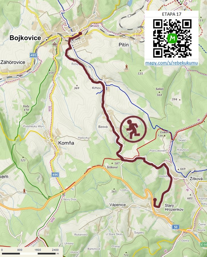

Route on the map
open on mapy.com
Parking at the finish
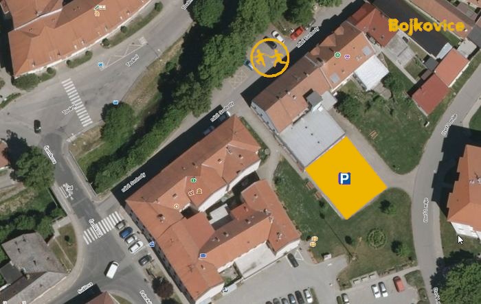
By car from the previous handover 10.8 km, about 14 minutes.
Download the stage card (PDF, in Czech) Download GPX
It's best to print the card from the downloaded PDF – it is laid out for two A4 pages.
