
27 Lanžhot – Břeclav
- 9.2 kmlength
- 14 mclimb
- 18 mdescent
- 1:33 hpenalty
Surface: 70% asphalt, 30% forest and field tracks
Elevation profile
0
2
4
6
8 km
Start
P27 Lanžhot
Lanžhot, sports ground 48.7235136N, 16.9723267E
Finish
P28 Břeclav
Břeclav, sports ground, 48.7428022N, 16.8968669E
Runner's route
From the sports ground through Lanžhot along Mlýnská I. and Luční streets, then past the Kout pond and across
the fields heading west. 4 km from the start, at the junction with cycle route No. 43, turn left and follow
the route to the Pohansko chateau. After the chateau turn right and run 1.9 km to the finish.
Route map
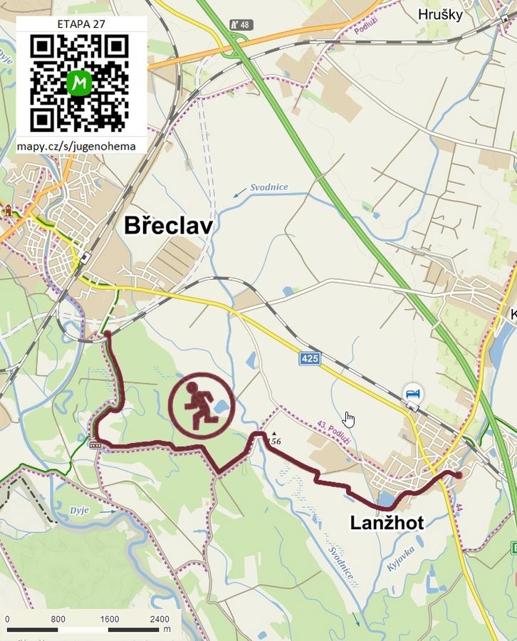

Route on the map
open on mapy.com
Parking at the finish

By car from the previous handover 7.4 km, about 11 minutes.
Download the stage card (PDF, in Czech) Download GPX
It's best to print the card from the downloaded PDF – it is laid out for two A4 pages.
