

30 Hlohovec – Mikulov
- 11.9 kmlength
- 155 mclimb
- 62 mdescent
- 2:07 hpenalty
Surface: 30% asphalt, 70% field track
Elevation profile
0
2
4
6
8
10 km
Start
P30 Hlohovec
Hlohovec - car park, 48.7795208N, 16.7576239E
Finish
Finish Mikulov
Mikulov - amphitheatre, 48.8131094N, 16.6393156E
Runner's route
100 metres after the start turn right between the ponds onto the blue marked trail. Continue 4.3 km along
the ponds on the blue trail to the village of Sedlec. At the junction turn right onto the road.
After 900 metres run down to the left onto a field track and after 100 m left again onto a field
track. After 1.9 km, at the junction with the road, turn left and right after just 20 metres (pond
on your right). Then continue on the blue trail (it leaves you on the climb past the quarry). At
the junction with the road (already in Mikulov) continue left and after 100 metres left again
along 1. května street. At the junction with Havlíčkova street turn right onto the yellow trail. Follow it
for 500 metres and then turn left onto the red trail towards the amphitheatre.
After 150 metres turn right into the amphitheatre.
Route map
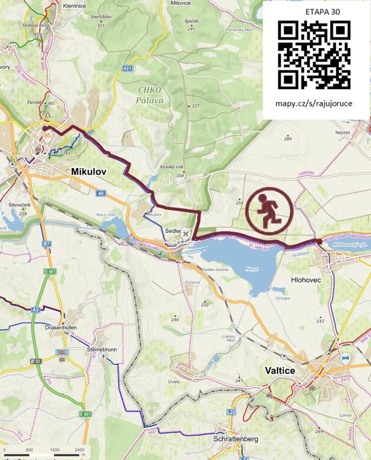

Route on the map
open on mapy.com
Parking at the finish
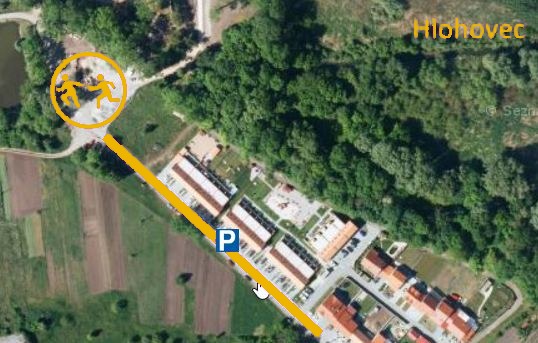
By car from the previous handover 20.5 km, about 26 minutes.
Download the stage card (PDF, in Czech) Download GPX
It's best to print the card from the downloaded PDF – it is laid out for two A4 pages.
