
10 Kohútka – Huslenky
- 8.4 kmlength
- 110 mclimb
- 466 mdescent
- 1:26 hpenalty
Surface: 10% asphalt, 10% forest track, 80% trail
Elevation profile
0
2
4
6
8 km
Start
P10 Kohútka
Kohútka, 49.2947472N, 18.2345192E
Finish
P11 Huslenky
Huslenky, Kychová 49.2764436N, 18.1477394E
Runner's route
From the start 4.2 km along the ridge on the red marked trail, then sharp left and 1.1 km down a steep hill (still on the red trail).
In Papajské sedlo turn right at the junction with the yellow trail and follow the yellow trail for 3 km downhill through the valley to the end of the stage.
Route map
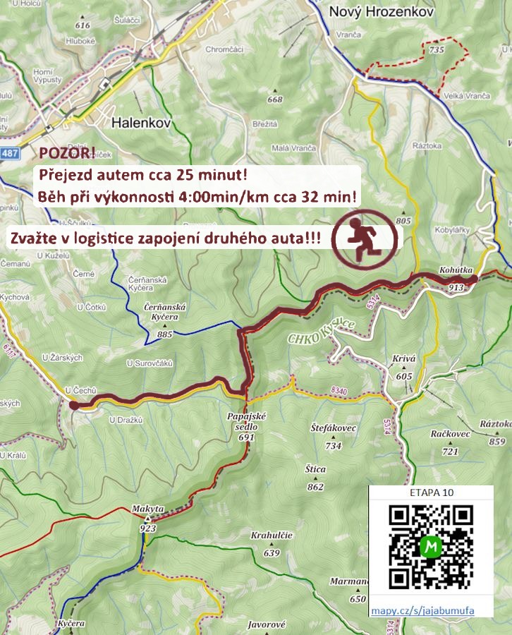

Route on the map
open on mapy.com
Parking at the finish
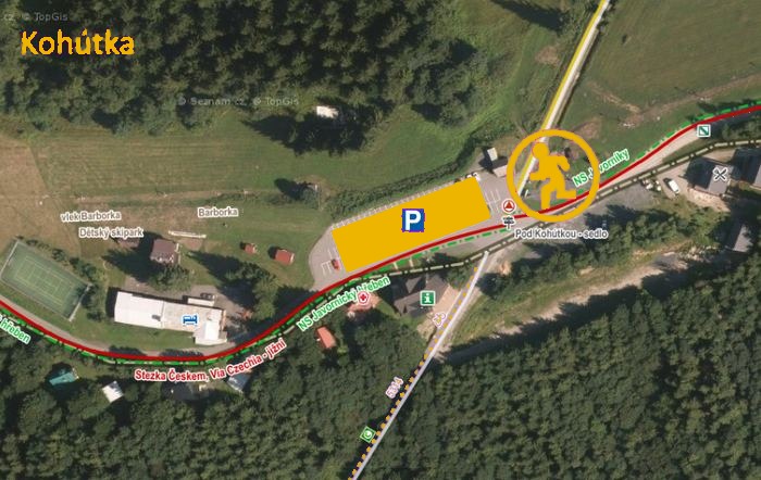
By car from the previous handover 26.7 km, about 39 minutes.
Download the stage card (PDF, in Czech) Download GPX
It's best to print the card from the downloaded PDF – it is laid out for two A4 pages.
