

11 Huslenky – Pulčín
- 13.4 kmlength
- 470 mclimb
- 318 mdescent
- 2:44 hpenalty
Surface: 50% asphalt, 30% forest and field tracks, 20% trail
Elevation profile
0
2
4
6
8
10
12 km
Start
P11 Huslenky
Huslenky, Kychová 49.2764436N, 18.1477394E
Finish
P12 Pulčín
Pulčín, 49.2199331N, 18.0768194E
Runner's route
The first 1.6 km is a steady 100 m climb, the next 2.2 km again 100 m down.
Then turn sharp left, off the green marked trail.
Then a steep 800 m climb and a 2 km descent, first on a stony track and later on
asphalt, into the village of Zděchov.
There turn left on the main road and continue for 3.2 km, all uphill. On the ridge
join the red trail and follow it straight on for 1.5 km along the ridge.
2.3 km before the finish leave the red trail and continue to the finish in the hamlet of Pulčín.
Follow the markings through the village.
Route map
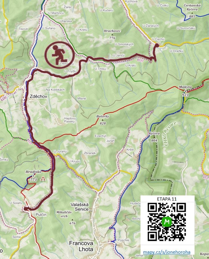

Route on the map
open on mapy.com
Parking at the finish
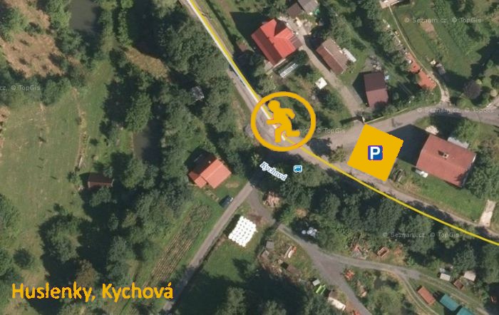
By car from the previous handover 29.4 km, about 39 minutes.
Download the stage card (PDF, in Czech) Download GPX
It's best to print the card from the downloaded PDF – it is laid out for two A4 pages.
