
13 Študlov – Návojná
- 11.4 kmlength
- 251 mclimb
- 416 mdescent
- 2:06 hpenalty
Surface: 60% asphalt, 10% forest track, 30% trail
Elevation profile
0
2
4
6
8
10 km
Start
P13 Študlov
Študlov, bus terminus, 49.1585350N, 18.0861778E
Finish
P14 Návojná
Návojná, outdoor pool, 49.1080494N, 18.0479172E
Runner's route
Follow the green marked trail; after 600 m turn left, then a steep 500 m climb along the Brumovka
stream up to cycle route No. 5059. On the asphalt road cross the crash barrier and turn LEFT
for 1.4 km on a gravel forest road. Then in the saddle turn right onto the red trail for 3 km to the junction with the road.
Then continue along the road for 5.5 km through the valley via Nedašova Lhota and Nedašov to Návojná.
In Návojná, before the chapel, turn right over the small bridge; right after the bridge turn left and continue 450 metres to the finish.
Route map
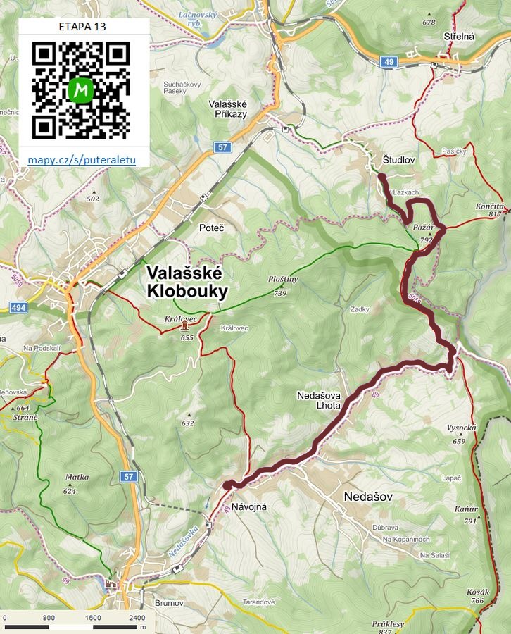

Route on the map
open on mapy.com
Parking at the finish
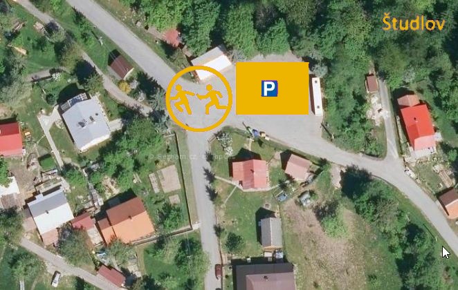
By car from the previous handover 16.4 km, about 20 minutes.
Download the stage card (PDF, in Czech) Download GPX
It's best to print the card from the downloaded PDF – it is laid out for two A4 pages.
