

21 Nová Lhota – Velká nad Veličkou
- 9.8 kmlength
- 44 mclimb
- 237 mdescent
- 1:40 hpenalty
Surface: 75% asphalt, 25% forest track
Elevation profile
0
2
4
6
8 km
Start
P21 Nová Lhota
Nová Lhota, 48.8608856N, 17.5936308E
Finish
P22 Velká nad Veličkou
Velká nad Veličkou - sports hall, 48.8801433N, 17.5147478E
Runner's route
800 metres along the main road through the village, then right, following cycle route No. 5046. On the
blue marked trail for only 250 metres, then bear left.
Continue all the way through the Hrubý potok valley – a steady descent.
When you reach the asphalt, keep following the main road through the village of Javorník – from the
municipal office on the blue trail. In Velká nad Veličkou, after the Coop shop and before the
tyre service, turn left and after 100 m right. After 300 m, past the sports hall, turn left.
Route map
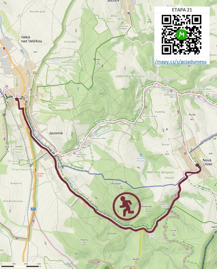

Route on the map
open on mapy.com
Parking at the finish
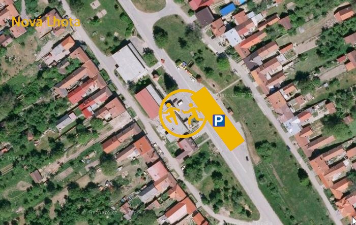
By car from the previous handover 10.5 km, about 15 minutes.
Download the stage card (PDF, in Czech) Download GPX
It's best to print the card from the downloaded PDF – it is laid out for two A4 pages.
