

20 Horní Němčí – Nová Lhota
- 11.8 kmlength
- 168 mclimb
- 285 mdescent
- 2:03 hpenalty
Surface: 60% asphalt, 40% trail
Elevation profile
0
2
4
6
8
10 km
Start
P20 Horní Němčí
Horní Němčí - Javořina junction, 48.9137661N, 17.6617256E
Finish
P21 Nová Lhota
Nová Lhota, 48.8608856N, 17.5936308E
Runner's route
From the start 2.8 km on the red marked trail and cycle route No. 46. At the Kamenná bouda junction
bear right – a path without trail markings, still on the cycle route. After 2.4 km the yellow trail joins; follow it on a steady descent through the stream valley via Vápenky.
After the last house on the right turn left into a climb on the blue trail. Follow the
blue trail for 2.5 km to the finish at the municipal office in Nová Lhota.
Route map
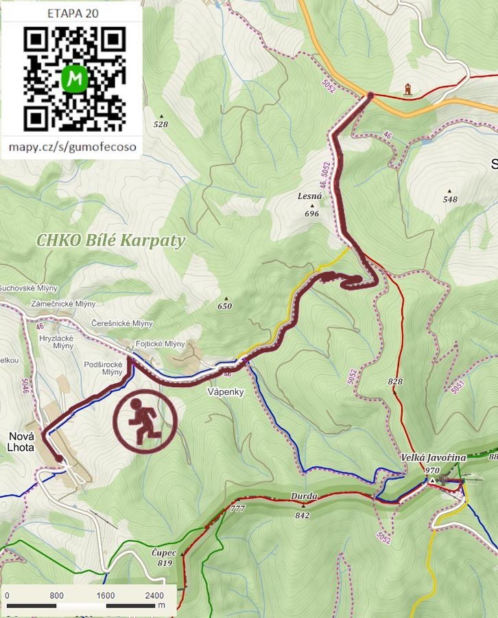

Route on the map
open on mapy.com
Parking at the finish
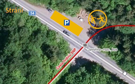
By car from the previous handover 20.4 km, about 20 minutes.
Download the stage card (PDF, in Czech) Download GPX
It's best to print the card from the downloaded PDF – it is laid out for two A4 pages.
