

23 Lučina, outdoor pool – Sudoměřice
- 13.8 kmlength
- 155 mclimb
- 273 mdescent
- 2:34 hpenalty
Surface: 30% asphalt, 70% field track
Elevation profile
0
2
4
6
8
10
12 km
Start
P23 Lučina, outdoor pool
Lučina - outdoor pool 48.8611175N, 17.3922178E
Finish
P24 Sudoměřice
Sudoměřice, 48.8643533N, 17.2559186E
Runner's route
50 metres after the start turn right and after the car park left along the road. After 300 metres keep left – in the Radějovka valley. 2.9 km from the start cross the stream to the left and after 100 metres turn sharp right onto a field track. After 1.6 km in Radějov, at the junction with the main road, turn left – on the blue marked trail. After another 150 metres left again – still on the blue trail. After 300 metres of climbing turn right – still on the blue trail. After another 200 metres bear right off-road – still on the blue trail. Then a 1.1 km climb through the forest. When you come out of the forest, turn left along the forest edge – not into the field! After a steep 1 km descent through the forest, after the footbridge turn right onto the green trail and follow it to Sudoměřice. In the village take the first street on the left and run 300 metres to the finish.
Route map
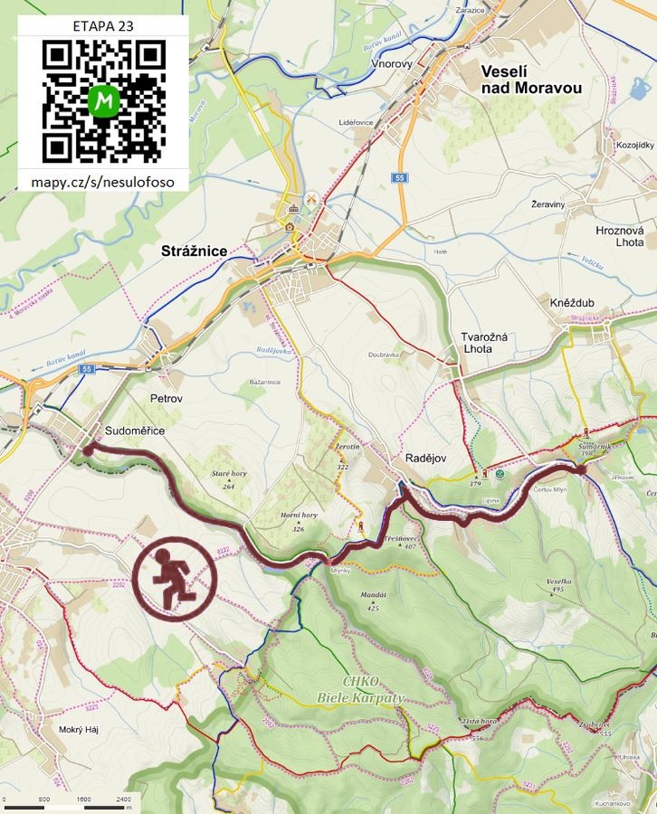

Route on the map
open on mapy.com
Parking at the finish
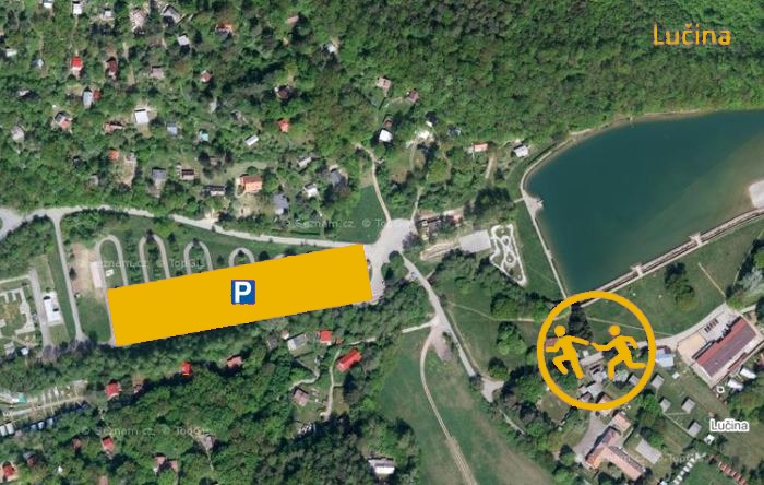
By car from the previous handover 14.7 km, about 19 minutes.
Download the stage card (PDF, in Czech) Download GPX
It's best to print the card from the downloaded PDF – it is laid out for two A4 pages.
